Indira Gandhi New Delhi International Airport Maps and Directions
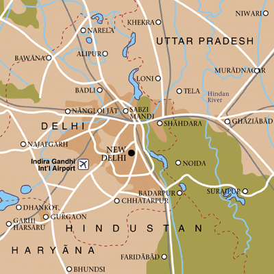
Indira Gandhi New Delhi International Airport Map
New Delhi Area Map

Driving Directions
The Indira Gandhi New Delhi Airport is located 23 kilometres (14 miles) south of Delhi, India.
From Pitampura
If travelling from areas in and around Pitampura, take the Rohtak Road eastwards and turn right onto Maraina Road. Travel southwards past the Mayapuri Industrial Area and then follow signs that lead to the Indira Gandhi New Delhi Airport.
From the Gurgaon Area
Take the Old Gurgaon Road northwards to arrive at the Indira Gandhi New Delhi Airport.
From the Udyog Vihar Area
Take the Sarna Jayanti Marg northwards to arrive at the Indira Gandhi New Delhi Airport.
Other major areas that can be easily reached from the Indira Gandhi New Delhi Airport include Kamla Nagar, Chanakyapura and Janakpuri, located north of the airport.
Featured Hotels


